VD Pro:10 watt 150 km bidirectional card transmission pull distance test
- Accessories, AIR, Battery, Carbon fiber, charger, CUAV, Date Link, dji, DLE, Drill, drone, ESC, F15, FPV, Gasoline, Generator, Generator for Drone, gimbal camera, hexacopter, Hot Shoe, light, LiPo, M1500, M300, mapping, mapping camera, MN1010, MN1015, MN501-S, MN505-S, MN601-S, MN605-S, MN701-S, MN705-S, MN801-S, MN805-S, Module, motor, Multispectral Camera, OMPHOBBY, payloadcamera, power, Propeller, Radio Module, Radio System, remote control, skydroid, smart controller, Solid-state Li-ion Battery, SUNNYSKY, Survey, Swan, T-Motor, T-MOTOR AIR, T-MOTOR Antigravity, tachometer, tarot, TATTU, test, Tethered Power System, thermalcamera, transmission, U10Ⅱ, U15, U3, U5, U7, U8, U8II Lite, U8Ⅱ, uav, Video Link, VTOL, ZMO, Zoom Camera
- 18 Apr, 2022
VD Pro parameters:https://insightfpv.com/products/vd-pro-15-150km-video-data-wireless-transmission-system
Test name: 10 watt 150 km bidirectional map transmission pull distance test.
Test date: May 31, 2019
Test location: West Tianmu Mountain, bank of Qiantang river.
Test method: West Tianmu Mountain places the master module and connects it to a computer to play videos; Qiantang river bank places the slave module and connects it to a camera or computer.
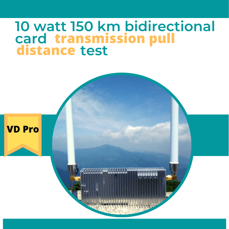
Test module model: BTD1211-PH20-40-150-1437, the test module is shown in Figure 1.1.

Figure 1.1 Physical diagram of the test module.
The height of West Tianmu Mountain is about 1.5 km. Set up the master module, connect the computer as shown in Figure 1.2, and connect two 16 cm 2dBi omnidirectional antennas. Test frequency point 1437.9MHz, transmit power 40dBm, bandwidth 20MHz, master-slave TDD configuration 1D4U (downlink-uplink time slot ratio 1:4).
Figure 1.2 West Tianmu Mountain main module end
Subject to the common constraint of Earth curvature and Fresnel radius, three locations can be selected as slave ends for the test according to Figure 1.3: at 130KM, where the see-through condition can be satisfied. At 140KM, where the see-through condition is not satisfied, and at 150KM, where the boundary distance of the module is 150KM.
Figure 1.3 Earth curvature, Fresnel radius
Test site 1: As shown in Figure 2.1, the bank of Qiantang River, about 130 KM away from West Tianmu Mountain, was selected.
Figure 2.1 Screenshot of the topographic map about 130 KM away from each other
The slave is connected to the computer and the host is connected to the computer for playback, and the connection information is shown in Figure 2.2. The SNR value can be stabilized by 10dB.
Figure 2.2 Link information at the West Tianmu Mountain end
The computer connected as a slave exchanges data with the computer connected as a host, as shown in Figure 2.3, and the system can provide an uplink at a code rate of about 10 Mbps at this time.
Figure 2.3 Uplink Rate
Test site 2: As shown in Figure 3.1, the bank of Qiantang River, which is about 140 KM away from West Tianmu Mountain, was selected.
Figure 3.1 Screenshot of the topographic map with a distance of about 140 KM
The slave is connected to the computer and the host is connected to the computer, and the connection information is shown in Figure 3.2. The SNR value can be stabilized at about 0 dB, and the SNR can provide a system uplink of about 3.5 Mbps at this time.
Figure 3.2 Link information at the West Tianmu Mountain end
Test Site 3: As shown in Figure 4.1, the Qiantang River dam was selected about 150 KM from West Tianmu Mountain.
Figure 4.1 Screenshot of the topographic map at about 150KM distance from each other.
The slave is connected to the computer and the host is connected to the computer, the connection information is shown in Figure 4.2, the SNR value can be stabilized in the range of -4~-2dB, the system currently cannot provide the bandwidth required for 1080P real-time video, but see Figure 4.3, the SNR can be stabilized in the range of 2~3dB. From the RSRP and SNR values in Fig. 4.2 and Fig. 4.3, it can be concluded that the spectrum of Qiantang River is cleaner than that of Xitianmu Mountain at a distance of 150 kilometers.

Figure 4.2 Link information at the West Tianmu Mountain end

Figure 4.3 Link information at the Qiantang River end of the 150KM distance

Figure 4.4 UAV module


✩ Hi
I need help with a device
VD Pro 15~150km Video/Data Wireless Transmission System
We purchased the device through your site
The two devices were connected and the green signal showed good,
and the camera was identified through IP
But we have a problem, which is that it cannot connect to the
Mission Planner program despite connecting a correct cable to the
Pilot
Please help is necessary